Introducing Pásek — a digital property passport
What Pásek is, why it exists and what it will do. First entry in the build diary.
Old houses share one certainty: the documentation either doesn't exist or it lies. The plans vanished during an inheritance, the 1980s extension was never drawn anywhere, and the only "blueprint" is a receipt with tape-measure numbers scribbled on it.
Pásek fixes that. Take an iPhone with LiDAR, walk through the house like a tourist — and within minutes you have a floor plan with areas, a 3D model and photo documentation. No surveyor, no month-long wait, no four-digit invoice.
What Pásek does
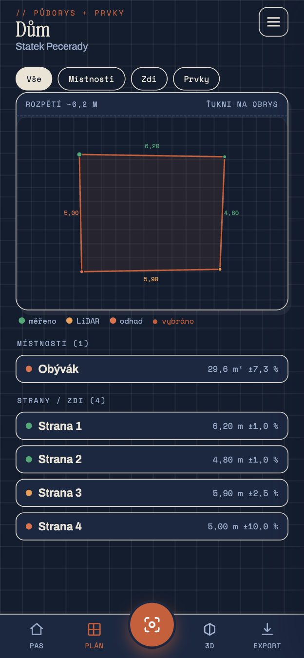
- Room scanning. Apple RoomPlan + ARKit read the walls, windows and doors. A single walkthrough produces a parametric model — not a point cloud you can't do anything with.
- Floor plans and areas. Areas, perimeters and heights with an honest tolerance. Manual tape measurements always override the scan.
- A property passport. Rooms, storeys, buildings, photo pins and notes in one place. Exported as PDF, a 3D model (USDZ) and machine-readable JSON.
What we stand on
- Your data stays with you. No account, no cloud, no server. The entire passport lives on your phone and never leaves it.
- One-time purchase. You buy Pásek once. No subscription for the privilege of opening your own data.
- Honest measurements. Every measurement declares its origin and uncertainty. Better
21.4 m² ±1.2 %than fake millimetre precision.
Where we are now
We're polishing Pásek and heading into a public beta. This blog will be its build diary: what worked, what didn't, and why. No marketing fluff — we'll describe how things really work, including where they have their limits.
Pásek is an orientation tool, not a geodetic survey. Its outputs don't replace official documentation or a boundary survey.
In the coming instalments we'll take the individual pieces apart up close. Next time we start with the most important one: how an iPhone can measure a room at all.